Location_State

Regional Groundwater Flow Model for the Lower Nooksack River
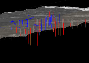
SSP&A developed a groundwater flow model covering the western portion of the Washington Water Resources Inventory Area 1 in Whatcom County.

Location_State
SSP&A developed a groundwater flow model covering the western portion of the Washington Water Resources Inventory Area 1 in Whatcom County.
SSP&A was initially engaged to assess groundwater conditions and develop and apply models to design, evaluate, and optimize groundwater remedies for CERCLA operable units across the Hanford Site.
SSP&A has designed sampling and analysis plans to determine groundwater and basalt chemistry, performed geochemical reactive transport modeling to predict the types and consequences of chemical reactions during ASR operations, and identified mitigation measures in cases where chemical incompatibilities between recharge water and basalt have been identified.
Translating the developing conceptual model, complete with the natural and man-made complexities described above, is a challenging task that is being undertaken jointly by S.S. Papadopulos & Associates, Inc. (SSP&A) together with GSI Water Solutions in collaboration with the GWMA.
SSP&A was retained to evaluate the locations, timing, and quantities of historical contaminant discharges to the Columbia River to support a potential Natural Resource Damage Assessment (NRDA) claim.

© Copyright 2012 - 2026 | Avada Website Builder by ThemeFusion | All Rights Reserved | Powered by WordPress