SSP&A provides data management and analysis services as an integral support service for any of the projects SSP&A takes on. Though often not the main focus, the success of environmental projects is data driven, requiring management and analysis of a variety of water quantity and quality data. Typical datasets include groundwater elevations, streamflow, evapotranspiration, precipitation, recharge, as well as contaminant concentrations and other water quality indices.

Data are typically compiled prior to the beginning of any evaluation and are obtained in different formats from federal, state, and local agencies, as well as private entities. SSP&A converts these datasets to appropriate digital formats and compiles them into suitable relational or meta-databases prior to use for project analysis.
Effective data management and analysis is critical for accurate and cost-effective planning, design, and implementation of water resource and environmental remediation solutions.
With in-house technical staff including earth and computer scientists who are fluent in several programming languages, SSP&A provides the following services:

Data Management for Natural Resources, Environmental, Engineering, and Water Resources Applications
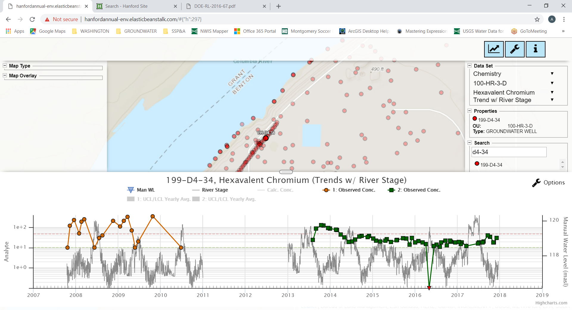
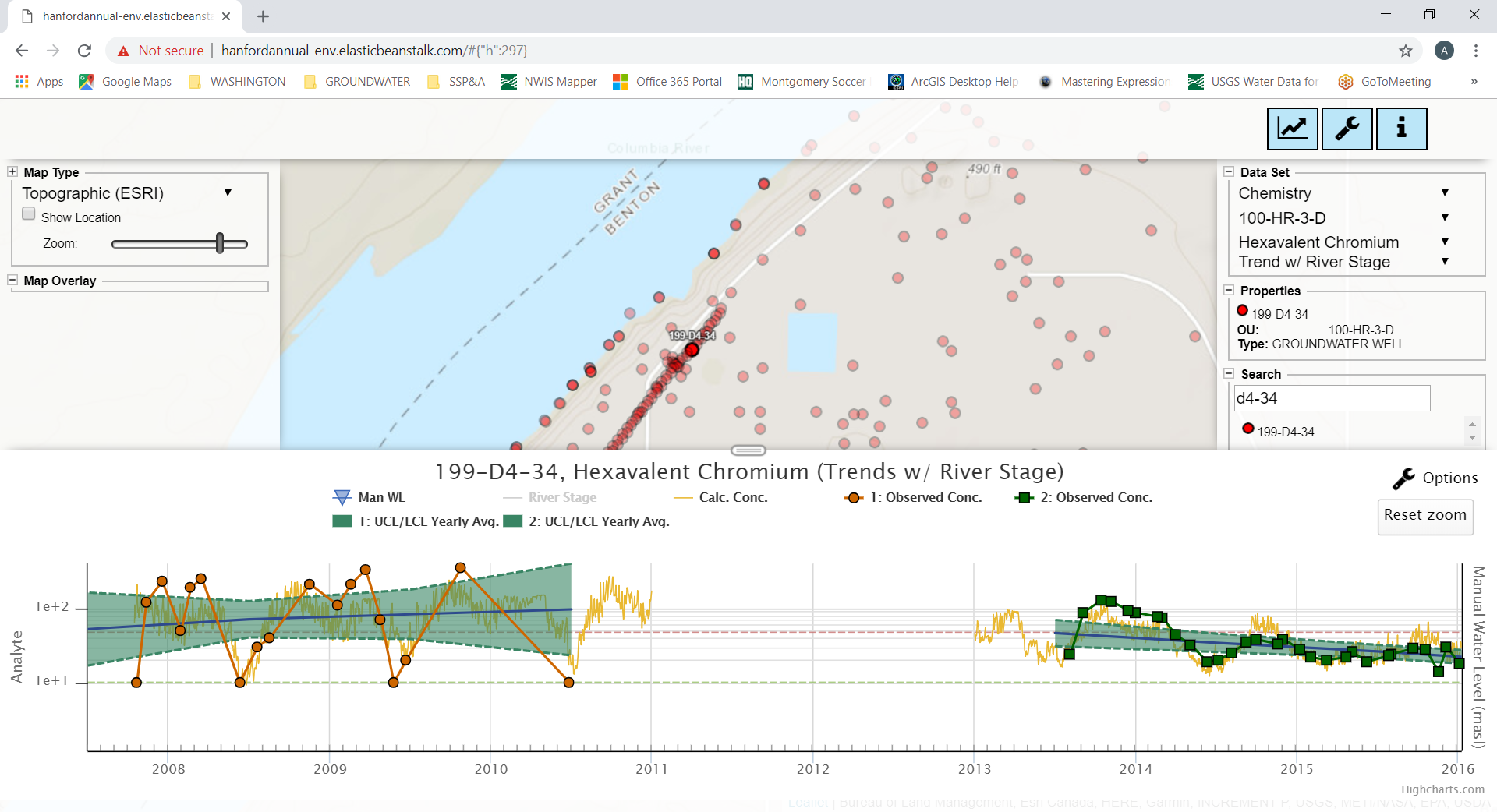
Designing, developing, and maintaining large geospatial datasets is an integral component of SSP&A’s projects. SSP&A provides expertise in constructing relational databases, with development of suitable input/output protocols to facilitate ease of access, consistency of data transfers, and effective dissemination of information for all related uses. Databases in Microsoft® Access, Postgres, and SQL are routinely constructed, with coded interfaces using programing in Python, R, C++, etc., to facilitate ease-of-use, archiving, data-transfer, and QA/QC of the entire spectrum of information and dedicated datasets.

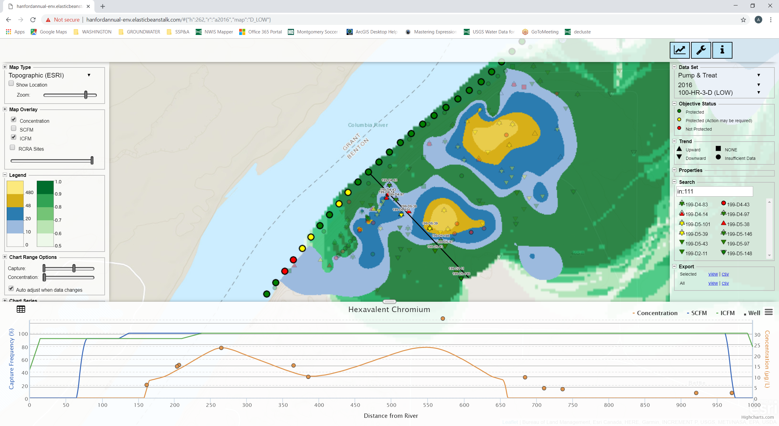
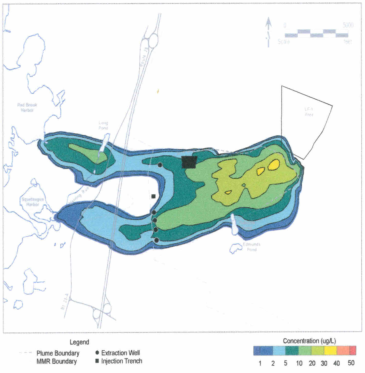
Water Level Maps
Figures A, B, and C above illustrate how seismically interpreted water levels (left) may be combined with monitoring well water levels (middle) to produce more detailed water level maps (right) that can help identify important subsurface features, such as a buried channel or groundwater divide, that are not identified using water levels maps created from well data only.
GIS Implementation, Design, and Creation
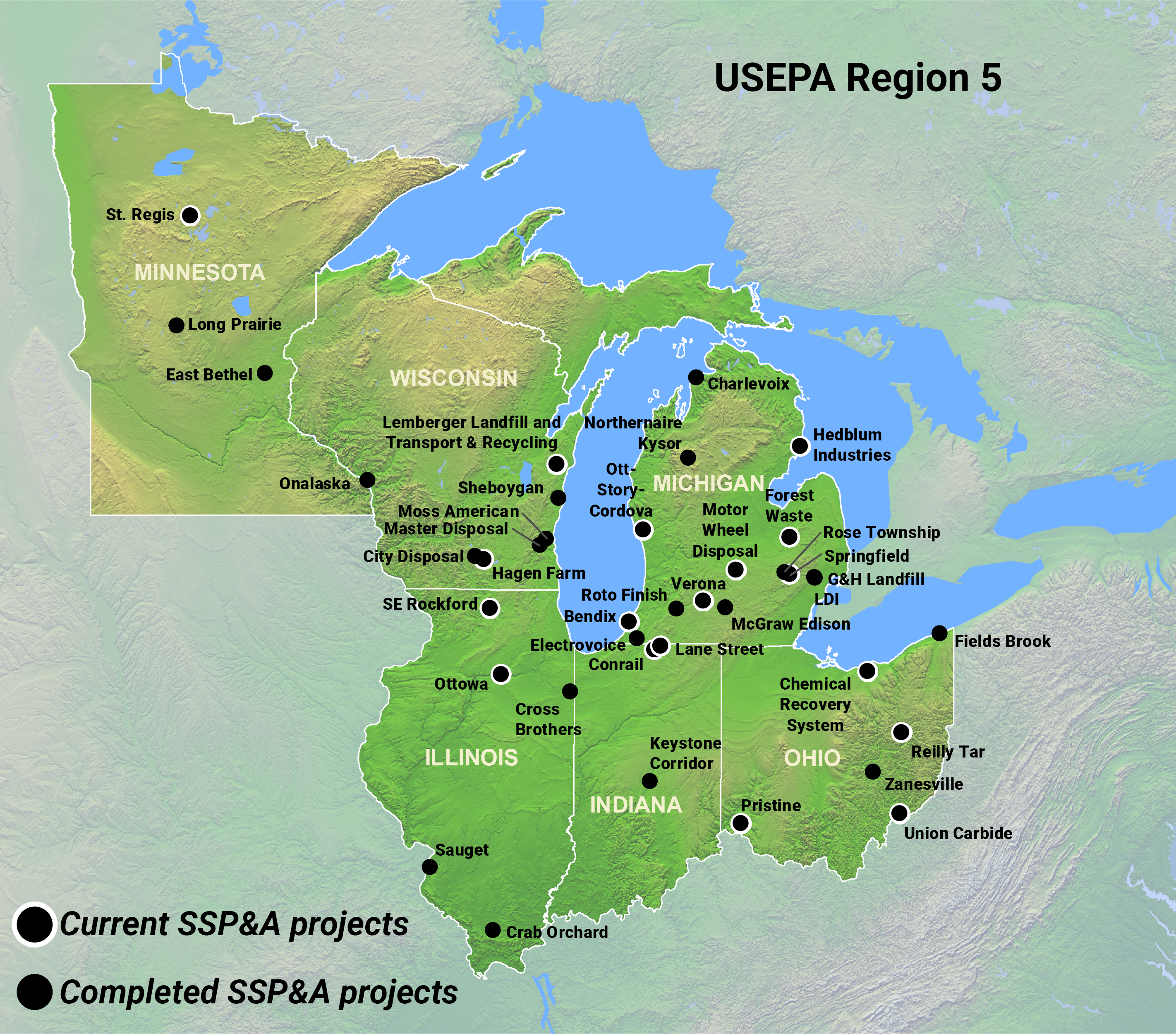
GIS is universally used in the display and mapping of environmental information. SSP&A’s GIS specialists produce figures to support analysis as well as detailed figures for final reports. Our capabilities include:
- Data conversion and georeferencing;
- Digitizing and data manipulation (raster to vector);
- Spatial and temporal 3D visualizations;
- Project design including GPS field methodology, field data analysis, and custom database design;
- Legal exhibits, publications, and courtroom graphics;
- Land use planning and zoning maps; and
- Development strategies and regional best management practices.
Our analysts use GIS and visualization software including ESRI’s ArcView®, ArcGIS™, QGIS, and EVS to provide custom graphical outputs, including large-format plots, 3D visualizations, and to deliver digital products for internet-based use or on-site integration. Examples of our digital products include:
- Time-series;
- Spatial data management;
- Remote sensing and aerial photograph acquisition and interpretation;
- Environmental database design;
- Natural resources monitoring and assessment;
- Soil and water quality analysis;
- Utilities and transportation route selection and mapping;
- Surface-water and groundwater modeling support;
- Geochemical site assessment;
- Regional climate and precipitation pattern mapping;
- Monitoring well site selection; and
- Watershed delineation.

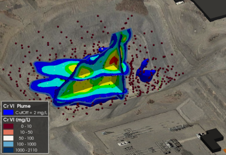
3D Visualizations
3D conceptual site model developed to evaluate the presence and significance of DNAPL observations, and to understand geological controls on DNAPL migration.
Machine Learning and Large Language Models
SSP&A uses machine learning (ML) and Large Language Models (LLMs) to understand large datasets. These tools enable us to organize and explore documents as well as numerical datasets. Using ML and LLMs creates advantages in efficient compilation and analysis of different kinds of data (numerical datasets) and information (collections of documents).
We are able to drastically reduce analytical time by leveraging on-premises Retrieval Augmented Generation (RAG) and image classification tools to generate meaningful analyses while protecting sensitive and controlled information. RAG enables us to evaluate, interrogate, and produce useful summaries of documents and datasets and prepare detailed preliminary analyses for review and confirmation by experienced staff. These services are used to support:
- Expert witness/litigation;
- Quickly understanding and checking for internal consistency across large datasets; and
- Development of code and specialized queries.
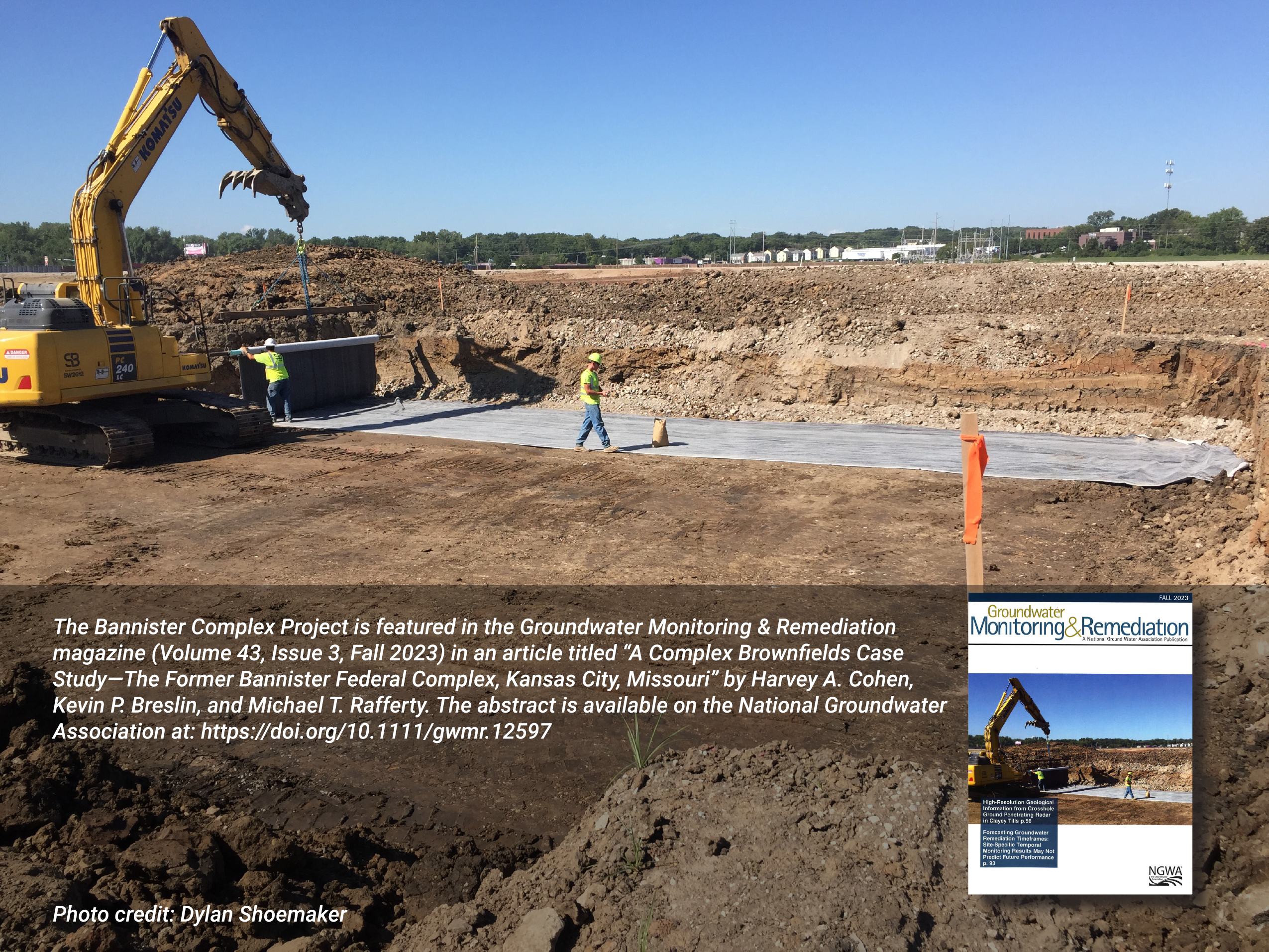
Gallery