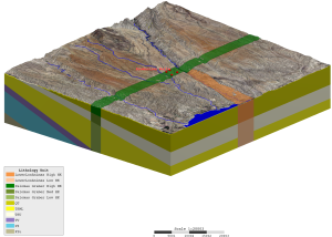
SSP&A developed a groundwater flow model covering the western portion of the Washington Water Resources Inventory Area 1 in Whatcom County.
Geochemical and Hydrogeological Evaluation of Former Yerington Mine Site
2024-11-21T23:17:10+00:00For nearly a decade, SSP&A assisted with the development and implementation of long-term management of contaminated groundwater at the Anaconda Copper Mine Site in Lyon County, Nevada.
Transco-Williams Groundwater Remediation
2025-02-11T19:53:24+00:00SSP&A works with the Mississippi Department of Environmental Quality and the Federal Energy Regulatory Commission to manage monitoring oversight and long-term management of the Transco-Williams facility.
Hanford Site Statistics and PHREEQC Geochemical Model
2024-11-21T17:09:28+00:00SSP&A was initially engaged to assess groundwater conditions and develop and apply models to design, evaluate, and optimize groundwater remedies for CERCLA operable units across the Hanford Site.
Castle East Mine
2024-11-21T17:11:01+00:00SSP&A was retained to develop a groundwater model to support a Category 3 Groundwater Permit to Take Water for Canada Silver Cobalt Works.
Leviathan Mine Site
2025-02-06T19:37:34+00:00SSP&A was initially retained to provide expert review and evaluation of hydrologic, hydrogeologic, and geochemical conditions at the former Leviathan Mine Site, and to assess the sources of impacts of mining-related residues on groundwater and surface water.
Texas Eastern Natural Gas Compressor Stations, PCB Support
2024-11-21T17:16:11+00:00For over 10 years SSP&A consulted to the NYSDEC spills department, evaluating and simulating the fate and remediation of fuel spills.
Fate and Transport Modeling of Fuel Additives
2024-12-06T22:52:40+00:00For over 10 years SSP&A consulted to the NYSDEC spills department, evaluating and simulating the fate and remediation of fuel spills at multiple sites.
Hyde Park Landfill – Remedial Action Assessment and Modeling
2024-11-21T17:22:44+00:00The Hyde Park Landfill is a hazardous waste landfill where approximately 20,000 tons of chlorinated compounds (primarily DNAPLs) were disposed in a fractured rock setting.
Aquifer Parameter Tool (Texture2Par) Development
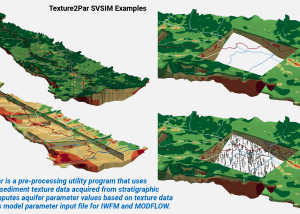
2024-12-06T22:38:50+00:00Texture2Par facilitates the assignment of aquifer parameter values directly to IWFM and MODFLOW model input files on the basis of sediment texture data acquired from stratigraphic logs.
Managed Aquifer Recharge Geochemical Evaluations in Basalts
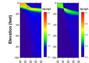
2024-11-21T17:28:39+00:00SSP&A has designed sampling and analysis plans to determine groundwater and basalt chemistry, performed geochemical reactive transport modeling to predict the types and consequences of chemical reactions during ASR operations, and identified mitigation measures in cases where chemical incompatibilities between recharge water and basalt have been identified.
EPA Region 5 Hydrogeological Synthesis and Numerical Modeling Support
2025-05-23T20:52:31+00:00Multiple Sites in EPA Region 5: Illinois, Indiana, Michigan, Minnesota, Ohio, and Wisconsin
Biggars Lane Landfill
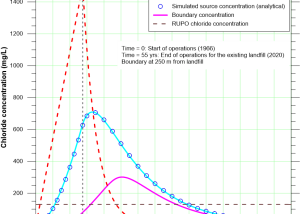
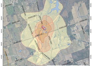
2024-11-21T17:35:24+00:00SSP&A developed analyses to predict the evolution of the concentration of chloride at a compliance boundary downgradient from an existing landfill and proposed new landfill cells.
Regional Municipality of Durham Groundwater Modeling Update
2024-11-21T17:39:12+00:00SSP&A was responsible for the local wellfield characterization for four communities including Cannington, Blackstock, Uxbridge, and Port Perry, in the Durham Region of Ontario, Canada.
Agricultural Aquifer Storage and Recovery Geochemical Modeling
2024-11-21T17:44:16+00:00ASR is a water resource management strategy used in central California to make use of a source water, such as spring snowmelt that flows in rivers and canals.
West Lake Landfill Site
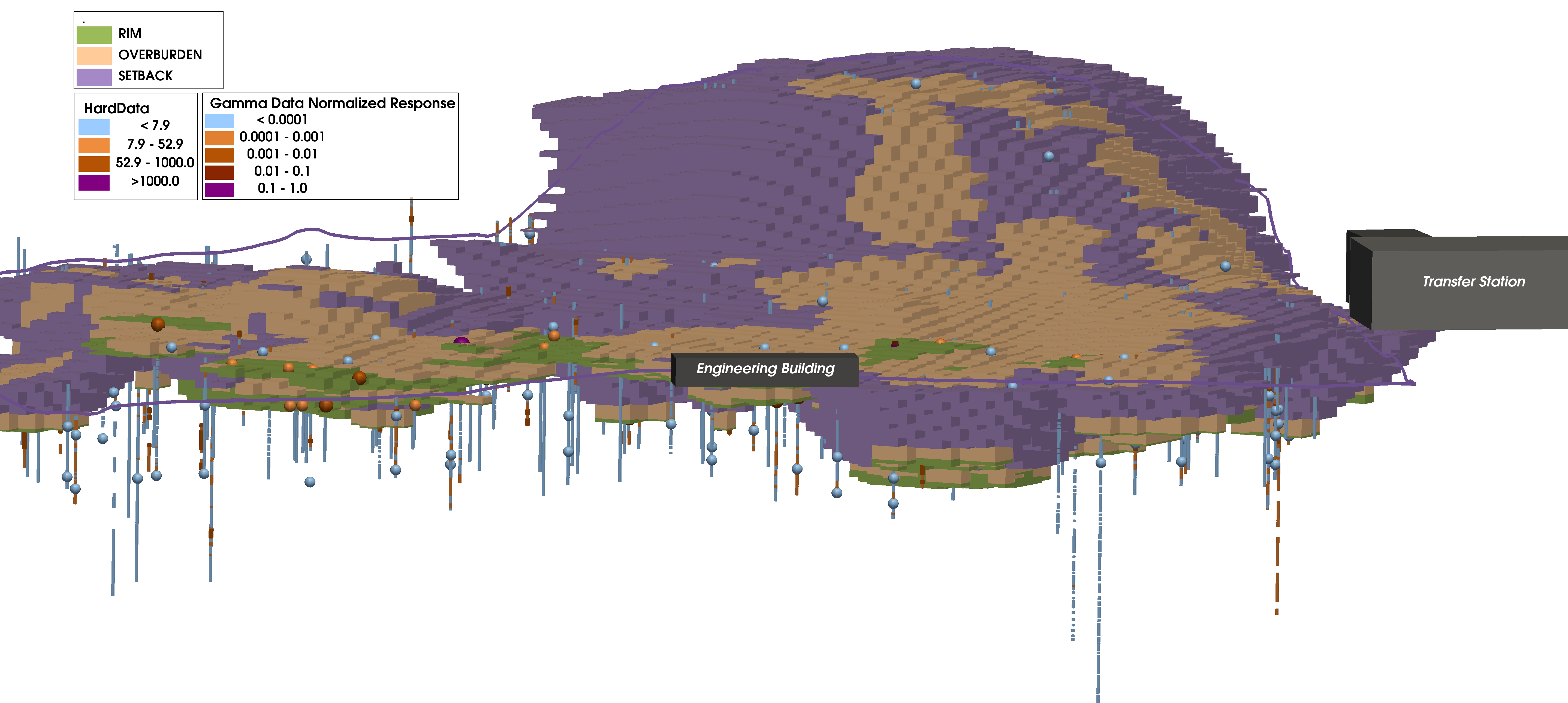
2024-11-21T17:46:08+00:00SSP&A was retained to estimate and depict the lateral extent and the volume of radiologically-impacted material (RIM) within Areas 1 and 2 of Operable Unit 1 (OU-1) at West Lake Landfill Site
Coronet Industries Alternative Site
2024-11-21T17:48:26+00:00SSP&A was retained to develop a groundwater transport model that would explicitly account for the long-term fate of arsenic and boron in aquifers underlying the Coronet Industries Alternative Site, located in Plant City, Florida.
Assessing Potential Impacts of the Tulla Transfer Application
2024-12-06T22:56:05+00:00To address concerns regarding groundwater/surface-water interactions and potential Rio Grande Project Supply impacts, SSP&A provided expert hydrogeologic support in the evaluation of the Tulla Resources application and developed possible strategies for offsetting any potential impacts.
Sparton Technology Remediation
2024-11-21T17:55:18+00:00SSP&A was retained by Sparton Technology, Inc., to assist in the development of a remedial plan, litigation support, and negotiations with federal, state, county and city regulatory authorities for its Former Coors Road facility in Albuquerque, New Mexico.
Water Resources Assessment, Pecos River Basin
2024-11-21T17:58:55+00:00To assist the State in their management of water resources in the Carlsbad Basin, SSP&A developed a graphical user interface for evaluation of water rights transfer applications which integrates an existing superposition groundwater model and advanced applications of the Glover-Balmer and Theis equations for analysis of locations outside the active extents of the groundwater model.
Water Resources Assessment, Lower Rio Grande Basin
2024-11-21T18:00:17+00:00SSP&A developed and calibrated a highly-detailed and refined historical groundwater flow model of the Lower Rio Grande Basin.
Water Resources Assessment, Salt Basin
2024-11-21T18:05:36+00:00On behalf of the New Mexico Interstate Stream Commission (NMISC), SSP&A was asked to provide expert insight into the State’s effort to assess feasibility regarding potential Salt Basin groundwater development for interbasin transfer either to the Pecos or Lower Rio Grande Basins.
Hanford Site: Groundwater Modeling
2024-11-21T18:15:38+00:00The USDOE Hanford Site transitioned over decades from a Manhattan Project mission to environmental assessment and cleanup. SSP&A was initially engaged to assess groundwater conditions and develop and apply models to design, evaluate, and optimize groundwater remedies for CERCLA operable units across the Hanford Site.
Former Halliburton Manufacturing Facility
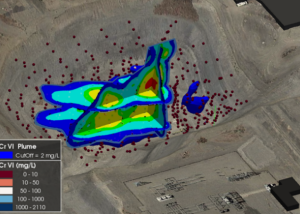
2024-12-10T20:06:06+00:00SSP&A was initially retained to evaluate the fate and transport of CrVI (from historical plating activities) and the effectiveness of a combined strategy of in-situ and ex-situ remedies.
OTIS AFB MMR Fate-and-Transport Analysis, Modeling, and Remedy Design
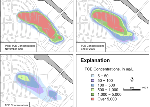
2026-01-05T22:45:53+00:00SSP&A developed and applied a 3D groundwater flow and contaminant transport model for the OTIS/MMR as part of remediation efforts at the site, and was subsequently retained to undertake wide-ranging data analysis, reporting, and remedy evaluation and optimization tasks.
Lane Street Ground Water Contamination Site
2024-11-21T22:24:16+00:00SSP&A was retained by the U.S. Environmental Protection Agency (EPA) Region 5 to evaluate groundwater conditions at the site and to collect environmental media to support the microcosm studies.
Columbia Basin Groundwater Management Area (GWMA) Groundwater Resources
2024-11-21T23:10:28+00:00Translating the developing conceptual model, complete with the natural and man-made complexities described above, is a challenging task that is being undertaken jointly by S.S. Papadopulos & Associates, Inc. (SSP&A) together with GSI Water Solutions in collaboration with the GWMA.
Hanford Natural Resources Damage Assessment Upwelling Study
2024-11-21T23:16:25+00:00SSP&A was retained to evaluate the locations, timing, and quantities of historical contaminant discharges to the Columbia River to support a potential Natural Resource Damage Assessment (NRDA) claim.


